katrina
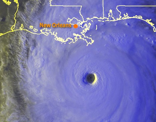
This photo was taken at 7 P.M. CDT. Katrina was 130 miles South of the mouth of the Mississippi River moving NNW at 11 miles per hour. Maximum winds at that time were 160 MPH. The central pressure was 904 millibars. Katrina had become a category 5 hurricane. This Katrina satellite photo was released by OSEI (Operational Significant Event Imager), part of the National Satellite, Data, and Information Service (NESDIS). Photo: TRCkatrina240_N5.jpg